
Page 42 - Summer 2021
P. 42
FEATURED ARTICLE
Twenty-Thousand Leagues Under the Sea: Recording Earthquakes with Autonomous Floats
Frederik J. Simons, Joel D. Simon, and Sirawich Pipatprathanporn
Fifty Years
Much like medical doctors who use X-rays or acoustic waves to make three-dimensional images of our insides, geophysicists use the elastic wavefield generated by earth- quakes worldwide to scan the deep interior of our planet for subtle contrasts in the propagation speeds of seismic waves. To image the deep Earth using seismic tomogra- phy, over the years, seismologists have densely covered the continents with seismometers to measure ground motion. As with medical tomography, where sources and detectors are rotated all around to illuminate our bodies from all angles, achieving similarly evenly distributed geographical coverage for seismology requires making measurements all over the Earth surface, including the two-thirds that are covered by oceans. Yet, although some ocean islands do host geophysical observatories, gathering data over marine areas continues to present unique challenges.
As early as the 1960s, seismologists began making seis- mic measurements on the ocean bottom, using motion sensors known as geophones that were sunk into the sediment. The small movements of the seabed convert to acoustic waves that can also be recorded in the water layer itself. Hence, soon thereafter, scientists started using deep current-tracking oceanographic floats to make measurements midwater, away from the difficult- to-access ocean bottom and away from the sea surface where wind and water waves generate unwelcome noise. This strategy opened up the oceans to drifting sensors capable of roaming over large areas. In particular, last year marked the 50th anniversary of the invention of a
“neutral buoyancy free-floating midwater seismometer.”
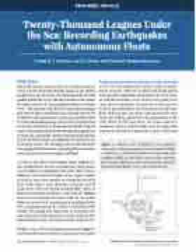
Bradner et al.’s (1970) drifting instrument (see Figure 1) was first and foremost meant to characterize the poorly
known marine acoustic soundscape, or noise spectrum, at the very low frequencies where seismic measure- ments are made. However, to detect and locate signals from specific earthquakes and measure the travel times of individual seismic waves so that wave speed varia- tions can be calculated, the position of the receivers must be precisely known and the time accurately kept. Both requirements presented unsurmountable chal- lenges for drifting underwater instrumentation at the time. Hence, by the mid-1970s, the action moved to sonobuoys (which could be kept track of using radio telemetry) and moored underwater buoys (which did
42 Acoustics Today • Summer 2021 | Volume 17, issue 2
©2021 Acoustical Society of America. All rights reserved.
Figure 1. Schematic view of Bradner et al.’s midwater seismometer. A three-component triaxial seismometer (SEIS) is contained in aluminum pressure housing, along with amplifiers (AMP), a crystal clock, a tape recorder, a pressure
“pot” to measure depth, and a radio recovery beacon transmitter. Reproduced from Bradner et al., 1970, with permission.
https://doi.org/10.1121/AT.2021.17.2.42
